Preface: Mode Shift is working to create a comprehensive online bike mapping source for southeast Michigan. In conjunction with this work, we will periodically feature some of the bicycle mapping activity already underway in the region. – Jessica Soulliere, editor
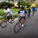
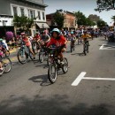
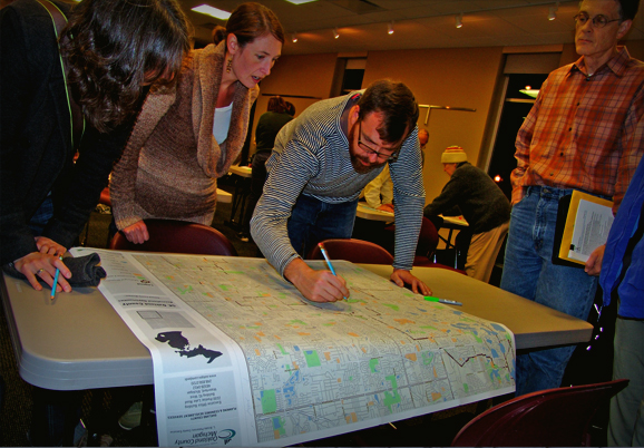
Royal Oak, Mich.—Royal Oak residents Matthew Faraday and Tom Regan have something in common: they both want to see more people on bikes in south Oakland County. That’s why, on a chilly evening last December, when most folks were tucked under comforters thinking nothing about bicycling, they called friends and fellow cyclists together to give input into creating a seven-city bike route map.
The meeting was held at the Royal Oak Public Library, where 50 folks milled in and out drawing their favorite routes on large maps provided by the Oakland County Mapping Department. Faraday is consolidating all the routes onto a master map. It will be color-coated for traffic volume, showing many residential street routes for people who don’t like riding on busy roads.
“The end result is that we’ll have a pocket-size map, almost like a tourist map, of this area by bike,” says Faraday. “It’s an effort to get more people back on bikes.”
The map will not be designed to highlight distance loops, but, rather, will identify routes to favorite destinations in Royal Oak, Ferndale, Pleasant Ridge, Clawson, Berkley, Birmingham and Huntington Woods.
Faraday moved to the area a couple years ago and is an avid cyclist. “It’s the first time I’ve been involved in anything meaningful. Biking is something I love to do, so it was pretty easy to get involved.”
Regan considers himself a commuter rider only. He rides mostly on Saturdays, going from the Royal Oak Farmers Market to Trader Joe’s to Meijer to shop, trailer in tow. He became involved in the mapping project through his volunteer work on the Royal Oak Environmental Advisory Board, a committee that advises the city about environmental issues, like recycling.
The mapping project is piggybacking off of a larger Royal Oak project, a full-blown non-motorized transportation plan. According to Regan, the plan has been undergoing review by the city’s Planning Department and debated at public hearings, but, if approved, it will be woven into Royal Oak’s Master Plan.
“Once the plan is approved, we can access state or federal enhancement grants to make improvements to make the city more friendly for bicyclists and pedestrians,” says Regan.
Regan says the Royal Oak City Planning Commission is expected to approve the non-motorized transportation plan during their meeting tonight. If approved, it is expected to be passed by the City Commission, which will likely consider the matter at one of two upcoming meetings Monday, May 7 or Monday, May 21. These meetings take place at 7:30 p.m. at Royal Oak City Hall.
Regan is concerned about bicycle safety and says that Royal Oak has a high rate of car-bike accidents. Regan was part of an ad hoc committee that formed a few years ago following two fatal accidents – one with a bike and motorist and one with a pedestrian and motorist.
The mapping group plans to cooperate with the Oakland County Economic Development Department: “We will give our map information to them, and they’ll give data back as part of their work around the county,” Regan notes.
Map-O-Rama: Want to get involved with Mode Shift’s regional mapping project? Send us a note!