Editor's note: This is the fifth part in a series on the 2014 Michigan Transportation Odyssey.
![]()
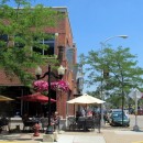
Big transportation projects are now zooming forward in Michigan’s capital city. Over the last few years, Lansing’s regional transit authority has been busy developing a high-speed bus system, and, thanks to the efforts of Lansing’s city government, bikers and hikers can now enjoy a shared-use non-motorized trail called the South Lansing Pathway.
Curious to learn more, the transportation advocacy coalition Trans4M stopped in East Lansing during its annual Michigan Transportation Odyssey trip. Participants got a chance to hear the project planners talk about their work and how community engagement fit into their process.
CATA’s Bus Rapid Transit Line
The Capital Area Transportation Authority (CATA) intends for their new Bus Rapid Transit (BRT) system to replace traditional Route 1 bus service along the Michigan Avenue/Grand River Avenue corridor. The 8.5 mile route will run from downtown Lansing near the State Capitol Building to the Meridian Mall in Okemos. It’s located on a bustling strip that’s home to many of the region’s top employers as well as educational centers like Michigan State University.
CATA spokeswoman Debbie Alexander says, depending on how many BRT elements are utilized, high-speed bus systems can be categorized as light, medium or heavy.
"We're going for the heavy,” she told Odyssey travelers during her Oct. 7 presentation, “and the reason is: we're looking at speed of boarding and speed of travel in the corridor. That’s our primary goal and that, of course, translates into capacity.”
At this stage, the system’s planned features include:
- 60 foot-long articulated hybrid buses with doors on both sides
- Signal Preemption
- Level boarding at stations
- Precision docking equipment to guide buses smoothly into stations
- Fare collection kiosks that allow fares to be collected at stations
- Dedicated bus lanes (one in each direction with different color and “T” to signify lane)
Under CATA’s plan, the route will be divided up into districts, and the system’s 28 stations, alignments and landscaping will be designed to differentiate them and create a sense of place.
Barring any obstacles, CATA will begin construction on the $194 million bus line in 2017.
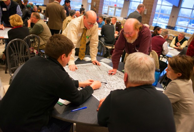
Right now, the project is still undergoing federal environmental review. Prior to submitting a plan for review, CATA solicited public input at several gatherings. The formats of these catered to the preferences of different communities.
In East Lansing, they held a charette, an intense planning session that mixes information gathering and design. That event lasted five days and featured hands-on design sessions.
In other areas, CATA held public meetings. Rather than simply have speakers address a general audience, the agency set up different tables, devoted to topics like street design, bikes and pedestrians, and economic development, where stakeholders could have their questions answered in a more personalized setting.
From their outreach, researchers learned that pedestrian and bike facilities, landscaping, on-street parking, station design and access were major public concerns and were able to craft several route alternatives. CATA is looking forward to more public input as they move ahead with station design.
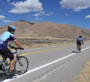
The South Lansing Pathway
The City of Lansing opened their new non-motorized trail, the South Lansing Pathway, this past December. The 5.5 mile paved path runs roughly parallel to nearby Jolly Rd, stretching east (with a brief northwards dip) from Waverly to Aurelius Road. It links the Lansing River Trail with Dehli Township’s still-under-construction Sycamore Trail. The pathway, built on a utility corridor owned by Consumers Energy, also features HAWK (High Intensity Activated Crosswalk) signals at several intersections to increase pedestrian safety.

Lansing city planners had talked about building the trail since the 1970s. Federal money finally helped make it a reality in 2014, with government funding covering around 80 percent of the $2.1 million project’s cost. Community involvement on projects like buffered bike projects lanes also helped to jumpstart the effort.
“We talked about how we’d been making plans forever,” Andy Kilpatrick, a Lansing transportation engineer, told the Odyssey group. “We had public input for nonmotorized projects, and I think that, along with our complete streets ordinance, allowed us to feel comfortable going forward with this.”
The city held a series of public meetings to gather input, which, for the planners, drew attention to concerns like policing, fencing and alignment.
“We altered the alignment of the path at two locations -- one due to concerns raised by residents and another based on snow clearing concerns of a business,” Kilpatrick told Mode Shift, “We also altered the location of a number of fences based on input from Consumers Energy.”
Police motorcycle patrols and volunteers are now keeping an eye on the pathway to address safety concerns. A wayfinder/mileage marker system is also being installed to help with navigation and to make it easier for people to relay locations in the event of emergencies, suspicious activities or maintenance issues.
This emphasis on community engagement reflects a shift in thinking that’s taken place in Lansing transportation planning over the last few years. Positive experiences with nonmotorized projects have shown engineers the benefits of not waiting until late in the process to consult stakeholders.
“We learned if we engaged them upfront, it may not change what we’re doing at all anyway, but then at least the public gets a first shot,” Kilpatrick said. “If there are significant issues, we can either go change them or decide this is not the right time for the project and go back later."